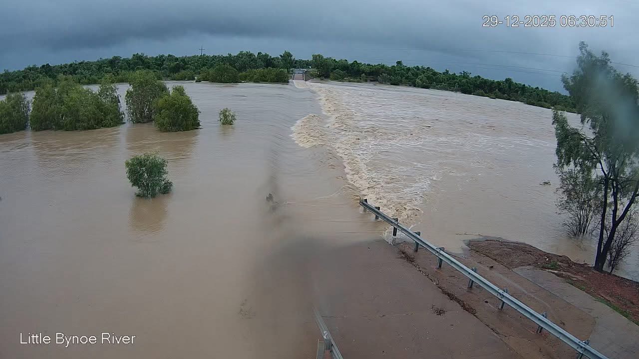
Widespread heavy rain continued over northern Queensland on Sunday, into Monday morning.
According to the Bureau of Meteorology, the highest observed rainfall in 24 hours, was on the north-east tropical coast and north-west parts of the state,including South Mission Beach (353mm), followed by
Oakland Park (south-east of Normanton) with 290mm, Fish Hole Creek (east of Normanton) with 288mm, Menavale (243mm), Cowley Beach (221mm), Euramo (214mm) and Upper Walker Creek (202mm).
Heavy intense rains are expected to continue in north-west Queensland and along the tropical north-east coast on Monday.
Similarly the National Weather Service in Indianapolis issued a warning against severe thunderstorms in Northwestern Hancock County in central Indiana, Morgan County in central Indiana, Northwestern Johnson County in central Indiana, Hendricks County in central Indiana, Southern Clay County in west central Indiana, Northern Owen County in west central Indiana, Marion County in central Indiana, Southeastern Hamilton County in central Indiana and Southeastern Putnam County in west central Indiana.
Residents are advised to remain alert for a possible tornado, which can develop quickly
from severe thunderstorms.
“If you spot a tornado go at once into the
basement or small central room in a sturdy structure.”
Picture: Bureau of Meteorology.