Most rainfall recorded by the Weather Service (SAWS) on Friday, the 16th January, was in Giyani at around 92mm, followed by Malonga (52mm) and Vuwani (37mm).
Elandshoek in Mpumalanga received 48mm, while Graskop had 29mm and Komatidraai (27mm).
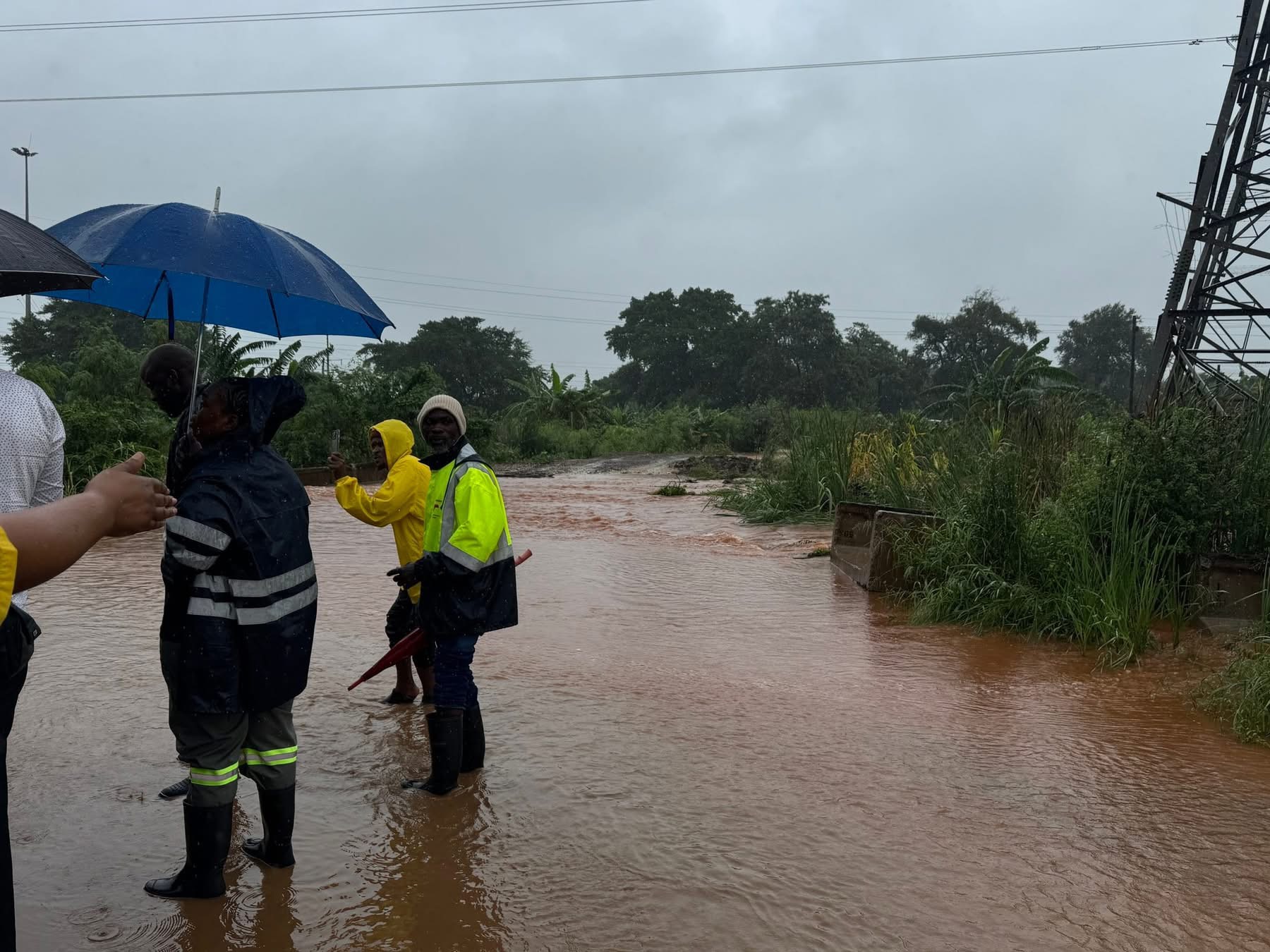
Videos of a flooded Beitbridge Old bus rank made rounds on social media, with the authority warning motorists passing through Beitbridge, not to cross flooded rivers, as some small bridges may have been damaged.
The South African National Roads Agency (Sanral) closed additional roads.
Madoda Mthembu, SANRAL Limpopo Provincial Head, said Routine Road Maintenance (RRM) teams remain on high alert and are conducting ongoing assessments to determine the extent of the impact on the national road network.
Thus far, these are affected roads:
The National Road R527 in the Hoedspruit area within the Maruleng Local Municipality. Alternative road is the R40 from Acornhoek through Hoedspruit towards Phalaborwa.
Others are the R40 next to Maseke Game reserve, 25km before Phalaborwa.
The R71 is closed.
- R578 section 2 Road washed away and closed
- R71-3 (Namakgale to Phalaborwa) near the Lulekani turn-off – flooded bridge
- R40-7 (Mica to Phalaborwa) near Grietjie – flooding across the road
- R36-5 (The Oaks to Ofcolaco) near Ofcolaco – pooling water over the road
- R527 – Zandspruit bridge is flooded
- R578 (Selwana road) near Makhuva – pooling of water over the road
- R578 at about km5.4 section 2, bridge washed away and road is closed.
- R578 at about km 20 section 2 is closed
- Greater Letaba bridge from R529 to Eiland road. Water level close to flooding the bridge
Open roads but full of water are:
- The National Road R81 in the Giyani town
- R33 between Groblersdal and Stofberg
- R526 section 2, km 12.4 from Gravellotte heading towards Hoedspruit
Thembi Simelane, the Minister of Human Settlements, sent an Emergency team to the disaster affected areas in Limpopo and Mpumalanga.
The team working together with teams from Mpumalanga and Limpopo provincial departments, are currently conducting physical verification of all households impacted by recent heavy rains.
Water and supply interruptions are widespread in parts of the Mopani district.
As a result, some residents of Burgersdorp, in Mopani, took to the streets on Saturday morning, demanding the restoration of electricity.
Eskom said on Friday, some areas are inaccessible to technicians, but assessments are underway.
Time of full restoration could not be determined.
Water Treatment plants supplying main affected areas packed up on Thursday, including Giyani, Nkowankowa, Tours, Thapane, Nkambako and Phalaborwa.
Speed Mashilo, MEC of Cooperative Governance, Human Settlements and Traditional Affairs (CoGHSTA), said about 193 households were damaged by floods in Mpumalanga, just this week.
The Human Rights Commission (SAHRC) said it is gravely concerned by the reported fatalities linked to flooding incidents.
“The SAHRC therefore calls on all spheres of government to ensure the immediate deployment of adequately resourced emergency personnel, rescue services and medical teams in all identified hotspots.”
The SAWS warning has dropped to Level 9, over the Lowveld of Mpumalanga and the eastern parts of Limpopo.
Another warning issued at Level 6, is over central parts of Limpopo (including Capricorn and Sekhukhune) as well as the Eastern Highveld (Emakhazeni, Msugaligwa, Mkhondo and Chief Albert Luthuli Municipalities.
Picture: Supplied