Meteorologists confirmed at least two cold fronts in the next seven days.
One is at an estimated 150 kilometres (kms) west of Cape Town.
This system is expected to bring isolated to scattered showers and rain to the south-western parts of South Africa on Tuesday.
The Severe Weather and Information Centre (SWAICSA) said a combination of an upper-air trough from the Atlantic Ocean and a surface trough over western South Africa, could bring along showers and thunderstorms over parts of the western, central and southern interior, on Thursday.
Severe thunderstorms could develop over parts of the southern Northern Cape, eastern Western Cape and western Eastern Cape.
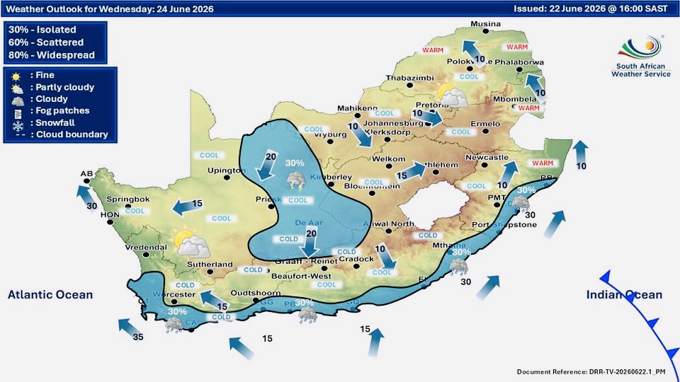
As a result, the South African Weather Service (SAWS) warned it would be partly cloudy and cool, with isolated showers and thundershowers over the central and western parts of the country.
Another cold front could bring moderate to heavy rain to the SW-Cape on Sunday evening into Monday next week.