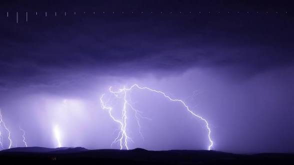
Meteorologists at the Severe Weather and Information Centre (Swaicsa) warned against a mature, active, “comma-shaped” Cut-Off Low (COL) on Sunday afternoon into Monday.
The system is expected to affect weather conditions over the central interior.
As a result, large parts of the eastern half of the country are likely to see the most active weather conditions over the next few days.
The South African Weather Service (SAWS) issued a Yellow Level 4 Warning, against severe thunderstorms on Monday, over the eastern parts of Free State, northern parts of kwaZulu-Natal and the escarpment areas of Mpumalanga.
Heavy downpours, lightning, hail and damaging winds are expected in those areas.
Similar yet lesser conditions are expected at Yellow Level 2, in North West (except for the extreme west), western parts of Free State, Gauteng, Mpumalanga Highveld (except the extreme north-west), and the the southern parts of kwaZulu-Natal.