

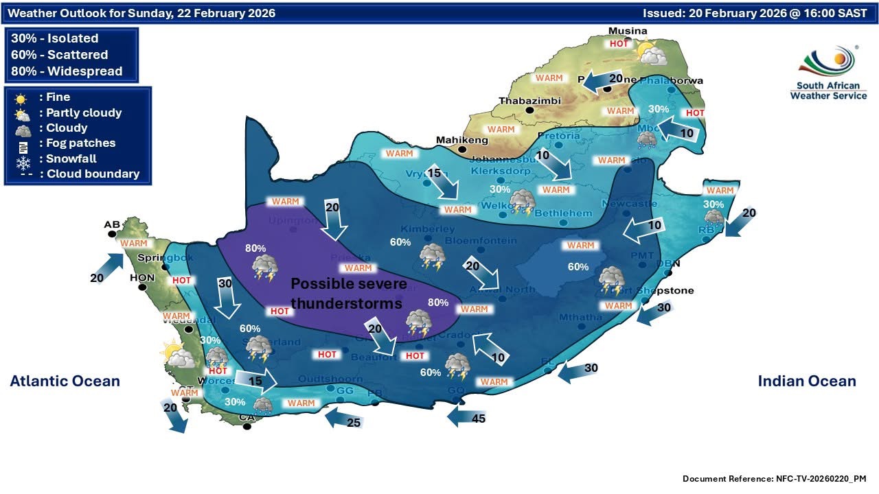
Meteorologist at the Severe Weather and Information System (SWAICSA), warned a Cut-Off Low (COL) system is creeping through the western part of South Africa.
Dr Angelo Hoorn of SWAICSA said the system was clearly visible on satellite imagery on Friday.
He explained “divergence occurs when air spreads out at upper levels of the atmosphere, creating space below that forces air to rise. This rising motion often leads to cloud and storm development — hence the extensive cloud bands. What you see on satellite is the cloud response to that upper-level circulation.”
As a result, severe weather conditions could spread to large parts of South Africa from Sunday into Tuesday next week.
The South African Weather Service (SAWS) confirmed the presence of a Cut-off Low (COL) over the western parts of South Africa, along with a surface low and Atlantic high-pressure ridge.
This is expected to bring scattered to widespread showers and thundershowers, on Sunday and Monday, to the Central and south-eastern Northern Cape, central and eastern Western Cape, Eastern Cape, southern and eastern Free State, and western KwaZulu-Natal.
Similar conditions over the Eastern Western Cape, western Eastern Cape, and southern KwaZulu-Natal on Tuesday.
Map: South African Weather System